
|
|
|
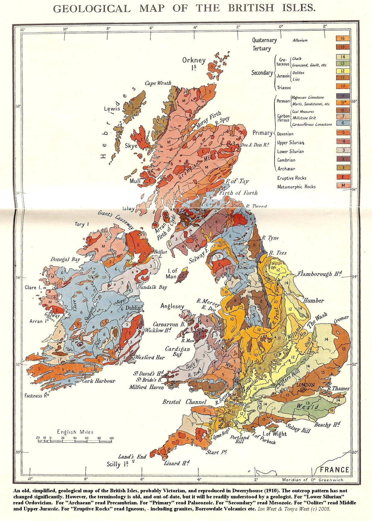
| Fig. 1: An old, simplified, geological map of the British Isles, probably Victorian, and reproduced in Dwerryhouse (1910). The outcrop pattern has not change significantly. However, the terminology is old, and out-of-date, but it will be readily understood by a geologists. For "Lower Silurian" read Ordovician. For "Archaean" read Precambrian. For "Primary" read Palaeozoic. For "Secondary" read Mesozoic. For "oolites" read Middle and Upper Jurassic. For "Eruptive Rocks" read Igneous, - including granites, Borrowdale Volcanics, etc. Ian West & Tonya West (c) 2008 | |
|
|
|
| Fig. 2: Geological map of Europe. | |
|
|
|
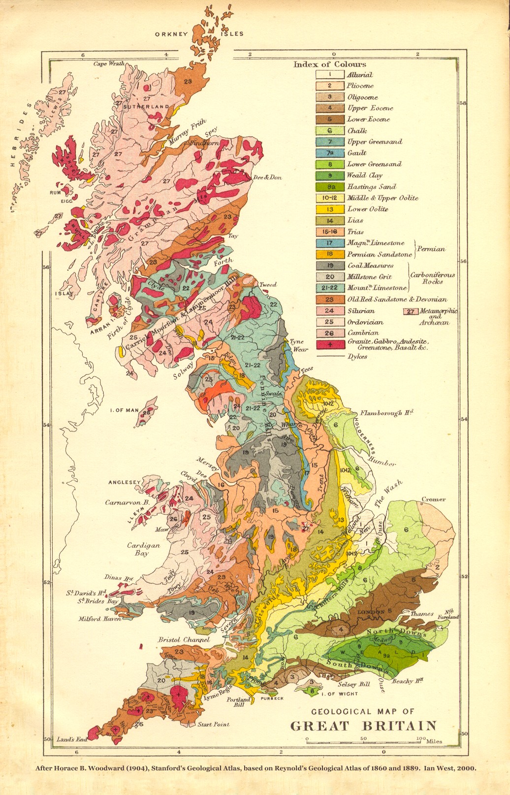
| Fig. 3: Geological map of Britain, after Horace B. Woodward (1904), Stanford's Geological Atlas, based on Reynold's Geological Atlas of 1860 and 1889. Ian West, 2000 | |
|
|
|
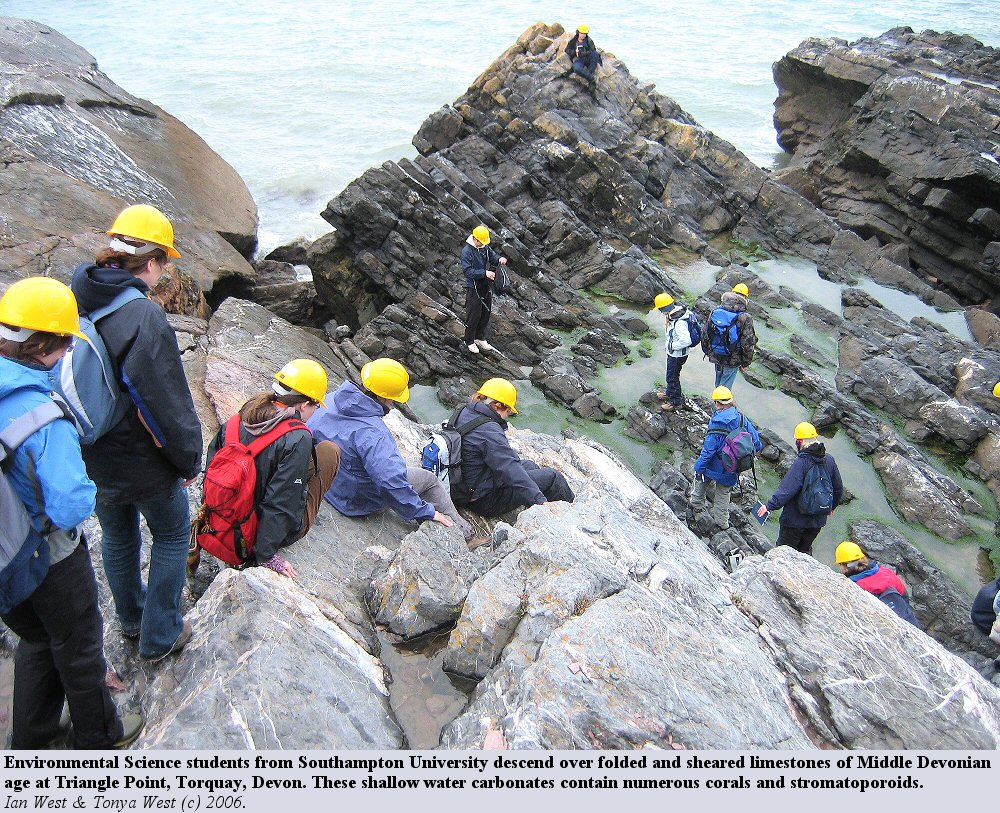
| Fig. 4: Environmental Science students from Southampton Universiy descend over folded and sheared limestones of Middle Devonian age at Triangle Point, Torquay, Devon. These shallow water carbonates contain numerous corals and stromatoporoids. Ian West & Tonya West, 2006 | |
|
|
|
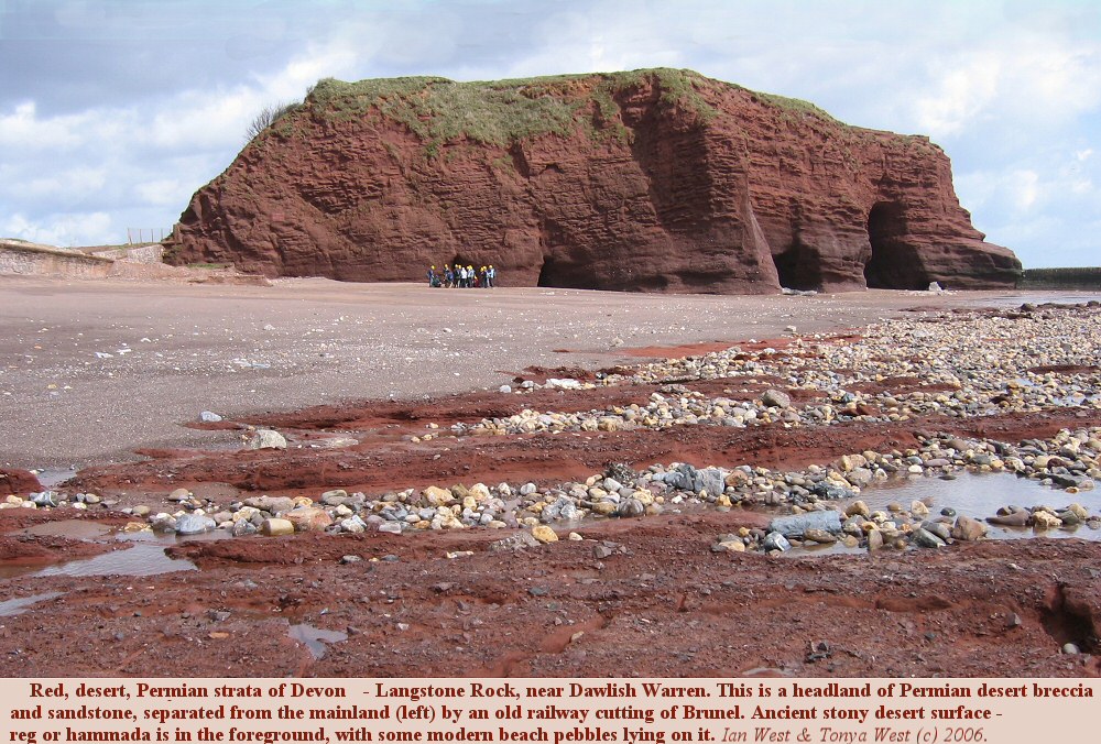
| Fig. 5: Red, desert, Permian strata of Devon Langstone Rock, near Dawlish Warren. This is a headland of Permian desert breccia and sandstone, separated from the mainland (left) by an old railway cutting of Brunel. Ancient stony desert surface - reg or hammada is in the foreground, with some modern beach pebbles lying on it. Ian West & Tonya West, 2006 | |
|
|
|
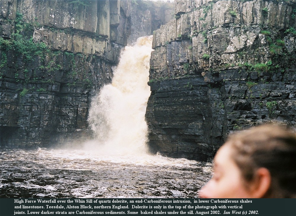
| Fig. 6: High Force Waterfall over the Whin Sill of quartz dolerite, and end-Carboniferous intrusion, in lower Carboniferous shales and limestones. Teesdale, Alston Block, northern England. Dolerite is only in the top of the photograph with vertical joints. Lower darker strata are Carboniferous sediments. Some baked shales uner the sill. August 2002. Ian West 2002. | |
|
|
|
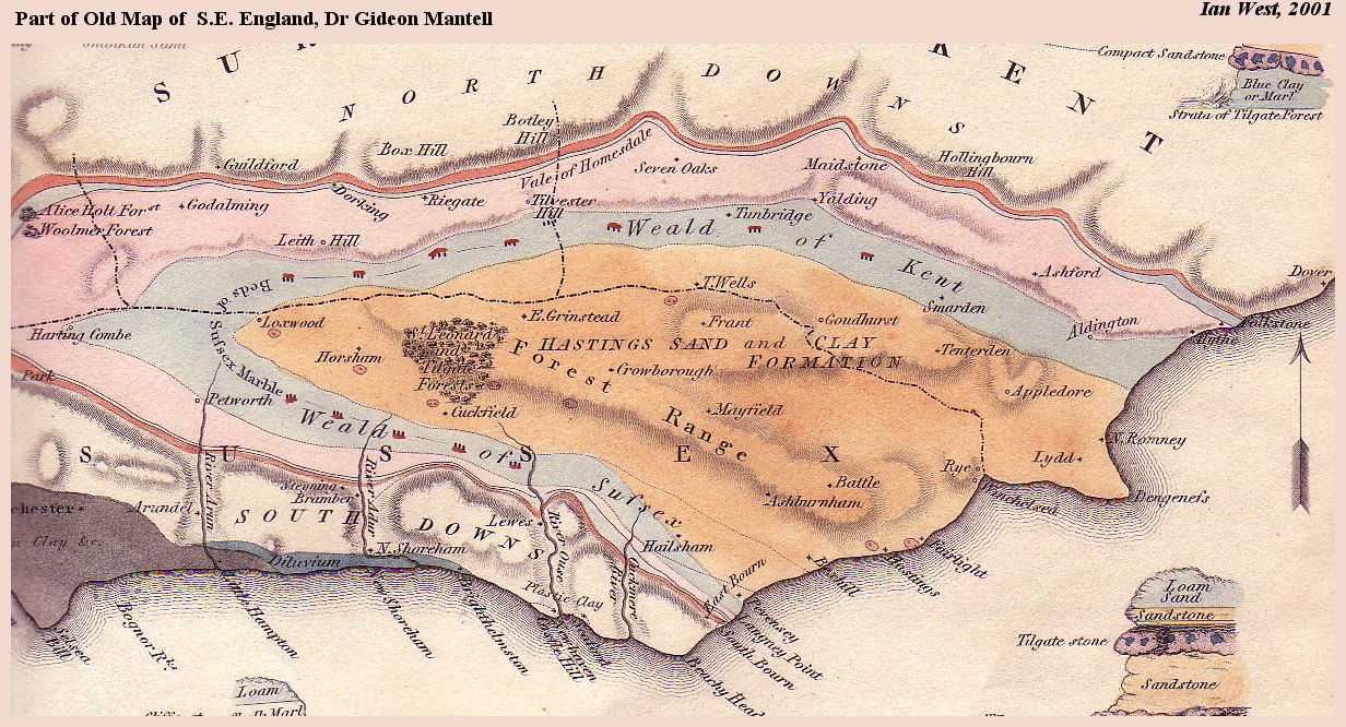
| Fig. 7: Part of Old Map of S. E. England, Dr. Gideon Mantell. Ian West 2001. | |
|
|
|
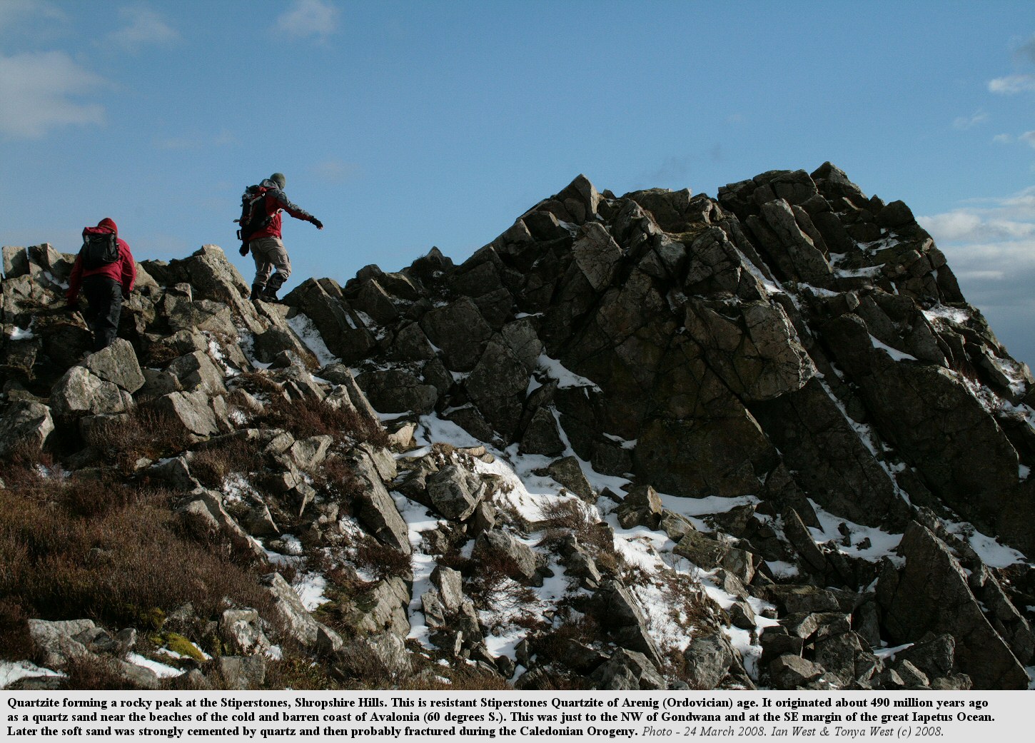
| Fig. 8: This is resistant Stiperstones Quartzite of Arenig (ordovician) age. It originated about 490 million years ago as a quartz sand near the beaches of the cold and barren coast of Avalonia (60 degress S.). This was just to the NW of Gondwanaland and at the SE margin of the great Iapetus Ocean. Later the soft sand was strongly cemented by quartz and then probably fractured during the Caledonian Orogeny. Photo - 24 March 2008. Ian West & Tonya West (c) 2008 | |
|
|
|
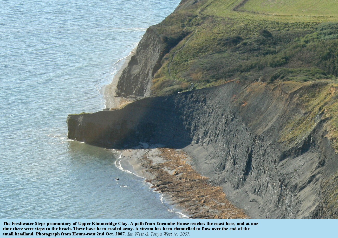
| Fig. 9: The Freshwater Steps promontory of Upper Kimmeridge Clay. A path from Encombe House reaches the coast here, and at one time there were steps to the beach. These have been eroded away. A stream has been channelled to flow over the end of the small headland. Photograph from Houns-tout 2nd Oct. 2007. Ian West & Tonya West (c) 2007. |
This page is an introduction to the series of webpages on the Geology of the Wessex Coast of the South of England. It is intended to provide introductory information on the geology of Great Britain. This will give the general background and facilitate understanding of the geology of the south coast. It may also prove to be of use for studies of geography and for various local studies. The first few maps show the general geology of Britain, the British Isles and Europe. The maps which follow show the geology of regions or counties within Britain and in more detail. These are arranged roughly from north to south. Some more detailed geological maps are provided in individual webpages on the geology of the Wessex Coast.
Note that only old maps are used here and these are only introductory and they are not intended to replace the modern geological maps of the British Geological Survey. The modern maps can be ordered over the internet and many of them are now available in digital form. For specific information on local areas refer to these new BGS maps.
Fig. 2 is a simplified geological map of Europe showing the setting of Britain in the broader context of Europe. Notice that Scotland, Wales, Cornubia (Devon and Cornwall) and Ireland, like Brittany, consist of old hard rocks. Considered in more detail, it is true though, that Brittany consists largely of Precambrian strata which rare in Britain where the older strata are mostly Palaeozoic. The Cantabrian Mountains and surrounding areas of northeast Spain are also of old rock. These regions of hard Precambrian or Palaeozoic rocks are usually hilly moorland or mountainous regions.
The relationship of Scotland to Scandinavia is interesting. Here are old metamorphosed ("crystalline" on the old map) Precambrian and Lower Palaeozoic strata, deformed in the Caledonian Orogeny when the ancient Iapetus Ocean was closed. The northeast-southwest trending, Caledonide Mountains of Scotland and Scandinavia are separated by the North Sea formed by some Mesozoic rifting and incipient continental drift of Britain towards the west. The Caledonides have been split even more to the west, with the Mesozoic and Tertiary formation of the Atlantic Ocean separating their southwest continuation as the Appalachians of the USA. Thus in broad terms, Scotland and Wales are related to Scandinavia, and Cornubia has some relationship to Brittany, which of course in geological terms includes the Channels Islands.
In contrast the hard rock upland areas, much of southern and southeastern England consist of low ground with softer Jurassic, Cretaceous and Tertiary strata. This part of the country is similar to the Paris Basin and its surrounds. The geology of the sea areas around Britain are not shown here, but they largely consist of Triassic, Jurassic, Cretaceous and Tertiary strata. Much oil occurs in traps in the North Sea. There is less in the English Channel, except near the British coast (the Wytch Farm oilfield extends into Poole Bay).
Fig. 3 is an old geological map of Great Britain showing in more detail the geology of the whole island, and also the relationship of the south coast sections to this. In general, as noted, older, harder rocks of Precambrian and Early Palaeozoic age (Cambrian, Ordovician and Silurian) occur in the west and north of Britain, with younger strata towards the southeast. Very old strata occur in Scotland and relatively young strata, of Tertiary (Eocene etc) age occur in the London and Hampshire Basins, as shown in brown. East Anglia has very young, Pliocene strata.
In southwest England, Devonian and Carboniferous slates, shales, sandstones and limestone occupy an extensive area. They produce a diverse coastal scenery. An exposure of the famous fossiliferous Devonian limestone of Torquay is shown in Fig. 4.
Major features of southwest England are the granites batholiths, such as Dartmoor, Bodmin Moor, Land End etc. These are the deep roots of acid volcanoes (the violent, explosive type). At the time of the volcanicity southwest England was situated near Newfoundland (this was, of course, long before the recent development of the Atlantic Ocean). The Dartmoor volcano can be regarded as the "Mount St. Helens" of the eastern side of the North American continent (Laurentia), and was similar associated with subduction (of the Rheic Ocean). The volcanic ash and lava reached the present site of the city of Exeter.
Permian and Triassic continental red bed facies, as shown in Fig. 5, are conspicuous features of the East Devon coast and give rise to the characteristic red scenery and soils. These are of desert origin when the region was in the Sahara Desert of the time and at about 15 degrees north. The Exeter area was in a central part of the great supercontinent Pangaea.
The middle stetch of the south coast, with which this set of field guides is largely concerned, consists of Mesozoic and Cenozoic strata (Jurassic, Cretaceous and Tertiary), with Cretaceous in the southeast.
Although this map is old, there has been very little change in the geological mapping on this scale, since it was drawn. The Isle of Man is now largely shown as Ordovician rather than Cambrian. There are some name changes. For "Mountain Limestone" read Carboniferous Limestone. The Lias is Lower Jurassic, but "Lower Oolite" would now be Middle Jurassic and "Middle and Upper Oolite" is Upper Jurassic. Hastings Sands and Weald Clay are parts of the Lower Cretaceous Wealden Group. The map is basically correct.
It is recommended to purchase the modern geological maps of Great Britain in two sheets, published by the British Geological Survey. These show much more details and with modern terminology. The standard geological maps in general use are the 1:50,000 geological survey sheets, which are again obtainable from the British Geological Survey. For some regions there are special larger scale maps, and there are also offshore geology map sheets (which include the adjacent land area). For full BGS map information please see their website on United Kingdom Geological Maps.
Fig. 6 shows one of the many features of geological interest in Great Britain. This is the end-Carboniferous (about 280 million year old) intrusion of quartz dolerite forming the Whin Sill. The river Tees flows over this at High Force on the Alston Block. The country rock is Lower Carboniferous limestone and shales. Corals occur in this near the foot of the falls. (Photographed on an Open University - SXR260 field trip from Durham)
As an introduction, these old geological maps are provided to give the simplified geology of various regions of Britain. From these it is possible to determine broadly the age of the strata and what type of rock exposures, fossils, minerals and soils might be expected in a region. They also show how Britain has developed over geological time, with the older strata in the north and west, particularly Wales and Scotland, and with younger strata in the southeast, particularly East Anglia. This is the result of progressive tilt towards the southeast and general slow subsidence in that region.
Because the maps are old, of Victorian vintage, and because they are on a small scale they are not precise and do not provide detailed formation boundaries. Most faults are omitted. They do show the broad outcrops of the major stratigraphical units and, incidently, they are also of some historic interest (note the many railway lines which do not now exist). They are not intended to replace the much more detailed and accurate modern geological maps available from the British Geological Survey. These newer maps show accurate formation and structural data and also information on the "drift" or Quaternary deposits, such as flood-plain silts and boulder clays. It is recommended that the appropriate modern maps be purchased for serious study or investigation of a specific area.
It should be emphasised that the old maps shown here are quite unsuitable for determing the rock type beneath, say, a specific building or building site. For instance, areas shown as Triassic sandstone on the Cheshire map are likely to have this as the dominant stratigraphical unit. However, clay beds can occur within it and Quaternary deposits, such as boulder clay, are not shown on these "solid geology" type maps. Study of a much larger scale, more detailed map is needed, as a prelude to a site survey. The British Geological Survey. may be able to help you.
Note that there have been some terminological changes since these old maps were produced. In particular the classification of the Jurassic strata is different now. The Lias has remained unchanged, but the "Lower Oolite" consisting of Inferior Oolite, Great Oolite and Cornbrash is now classified as Middle Jurassic. The so-called "Middle Oolite" and the "Upper Oolite" is now all Upper Jurassic. The Upper Jurassic now consists of the upper part of the Oxford Clay, the Corallian, the Kimmeridge Clay and the Portland Group. Apart from this there have been some changes in detail. Various names "Beds" have become Groups or Formations. The "Fluvio-Marine Series" is now the Solent Group and the Eocene/Oligocene boundary is within it, not at the base. The Precambrian (note - one word now) is mostly Proterozoic and not Archaean. In a broad sense the maps are quite satisfactory, provided the Oolite/Jurassic problem is remembered. In any case, they are better than more detailed maps for "seeing the wood for the trees".
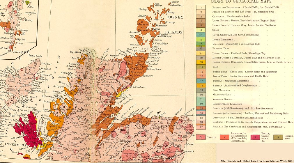
Much of northern Scotland is occupied by old hard rocks, listed in the legend of the map as 27 - "Archaean (Pre-Cambrian) and Metamorphic; 27a Torridonian". These strata are indeed largely Precambrian, perhaps with some Cambrian, but not necessarily as old as Archaean. Not indicated on the map, but trending northeast-southwest through Loch Ness and the Moray Firth is the Great Glen Fault. North of this these old strata are largely classified as the Moine succession and are relatively older (Anderton et.al., 1979). The Torridonian deposits in the northwest represent late Precambrian red beds, an interesting facies of hematite-stained sandstones. To the south of the Great Glen Fault the area of unit 27 largely shows the outcrop of the Dalradian Supergroup. This is a very interesting succession of predominantly late Precambrian age (Proterozoic) which includes both evidence of ancient glaciation (the Port Askaig Tillite) and, in contrast, pseudomorphs after gypsum in some beds.
Notice the late Silurian - Devonian granites in the southeast of the area. These were emplaced in the final stages of the dramatic closure of the ancient Iapetus ocean (Anderton et.al., 1979) . The two margins of this northeast-southwest trending ocean came together by plate tectonic movements and slow continental drift. The areas of England and Wales (previously far to the south in the latitude of about New Zealand today) and Scotland (in tropical latitudes) were joined approximately on the line of the Solway Firth. In the Caledonian Orogeny, which resulted, there was much volcanism, and the emplacement of the granitic magma. Much later erosion of the surrounding strata left the hard granites as uplands, such as the Cairngorm Mountains. In the Aberdeen and Peterhead area the granite has been much quarried for building stone.
Note the Devonian or Old Red Sandstone (23) in Caithness and other areas in the northeast. This region is famous for the fish beds which occur at certain horizons and attracted the attention of the well-known early geologist and best-selling author Hugh Miller.
Igneous rocks, shown in red, in the islands of Skye and Rum are early Tertiary volcanics. These originated when north-west Scotland was close to the early mid-Atlantic ridge as the North Atlantic was first opening (equivalent position to Iceland at the present day). Shown mostly in yellow on Skye and Raasay are limited areas of Jurassic marine and lagoonal sediments. These are fossiliferous sandstones and shales and can be correlated with Jurassic strata in the main outcrops of Dorset, the Midlands and Yorkshire.
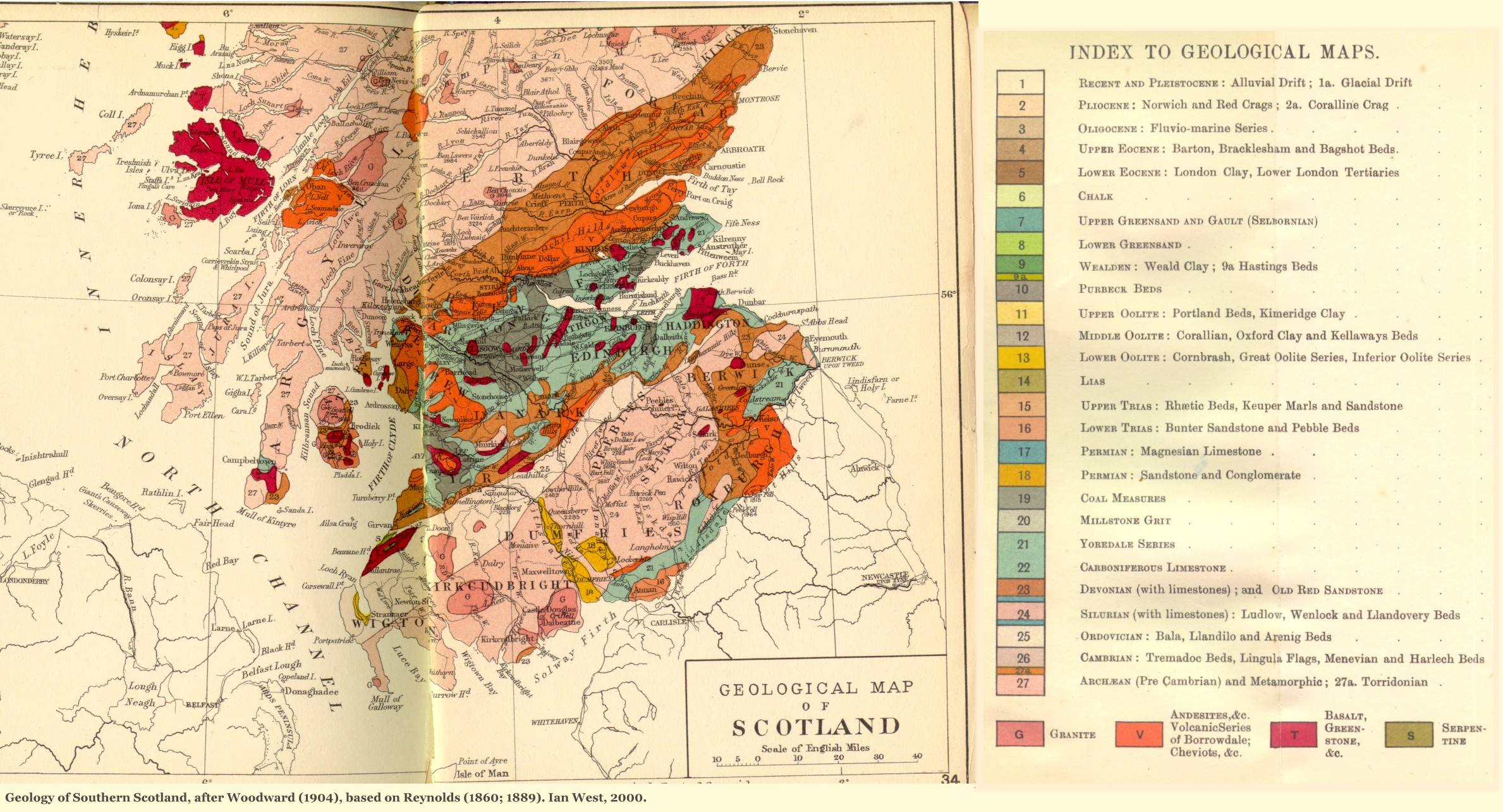
The southern part of Scotland which this map presents consists of three main parts. The northern part, the Highlands are a southern continuation of the ancient and metamorphosed Dalradian strata shown in the previous map (above). The upland areas result from the resistance to erosion by these hard rocks. To the west, on the coast in Mull and elsewhere there are the Tertiary igneous rocks again. The middle part of the map area is the Midland Valley of Scotland. Here there is Old Red Sandstone of Devonian age, much Carboniferous including Carboniferous Limestone and Coal Measures and also volcanic rocks. This trough is fault-bounded, although the Highland Boundary Fault (to the north) and the Southern Uplands Fault (to the south) are not shown on this particular map. You can estimate their approximate trends, but you need to consult larger scale maps for the exact positions. Notice in the west the fascinating Isle of Arran, so popular with geologists. There are a wide variety of rock units here (why is this?), including igneous rocks, and they are well-exposed. The third and southermost part is the Southern Uplands. These consist largely of Silurian strata with some granites, although other stratigraphical units are also involved.
Again, it should be emphasised that the maps shown here do not give details, and it worth while to study the quite complicated and very detailed 1:50,000 or one inch to one mile Geological Survey Sheets of Scotland.
The early 19th Century geological map of southeast England shown in Fig. 7 is of considerable historic interest. It is a classic map which shows amongst other features the geology of Tilgate Forest in the Weald, where the wife of Dr Mantell was the first person to discover the remains of a dinosaur. The name "Dinosaur" - "Terrible Lizard" came from this find of a tooth like that of the Iguana lizard but of very large size.
I am very grateful to Dr Ronald Austin for the original coloured map and sections by Dr Gideon Mantell. Note, incidently, that the "Limestone of Ashburnham" is now know as the Purbeck Formation (or Group) of mostly Cretaceous age, the Hastings Sands and Weald Clay are part of the Lower Cretaceous Wealden Group. The "Shanklin Sand" is Lower Greensand (Cretaceous), the "Galt" is the Gault Clay (Upper Cretaceous), the "Firestone" is Upper Greensand (Albian, Upper Cretaceous), the Chalk is labelled as such and the "Plastic Clay and Sand" is the Reading Formation of Palaeocene age.
[1] R. Anderton, P. H. Bridges, M. R. Leeder and B. W. Sellwood, A Dynamic Stratigraphy of the British Isles; A Study in Crustal Evolution. (George Allen and Unwin, Boston, Sydney, 1979).
J. R. Earp and B. A Hains, British Regional Geology: The Welsh Borderland. (Her Majesty's Stationery Office, London, 1971). [Based on previous editions by R. W. Pocock and T. H. Whitehead.]
A. Hunter, The Geological History of the British Isles (Open University, 2001). [SXR260. Science: a level 2 course.]
Pearce, A., Mining in Shropshire (Shropshire Books, 1995).
Pocock, R.W. and Whitehead, T.H., British Regional Geology: The Welsh Borderland, Second Ed. (Her Majesty's Stationery Office, London, 1949).
I am very grateful to my daughter Joanna Bentley, to Ben Bentley, Daniel Bentley, Max Bentley and Sam Bentley for accomodation and help with fieldwork in Shropshire. I much appreciate help in the field from many geologists and geology students.
 Northern Scotland |
 Southern Scotland |
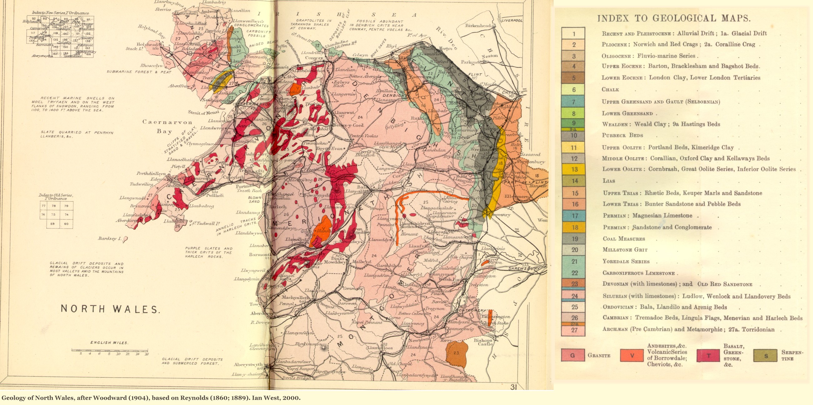 North Wales |
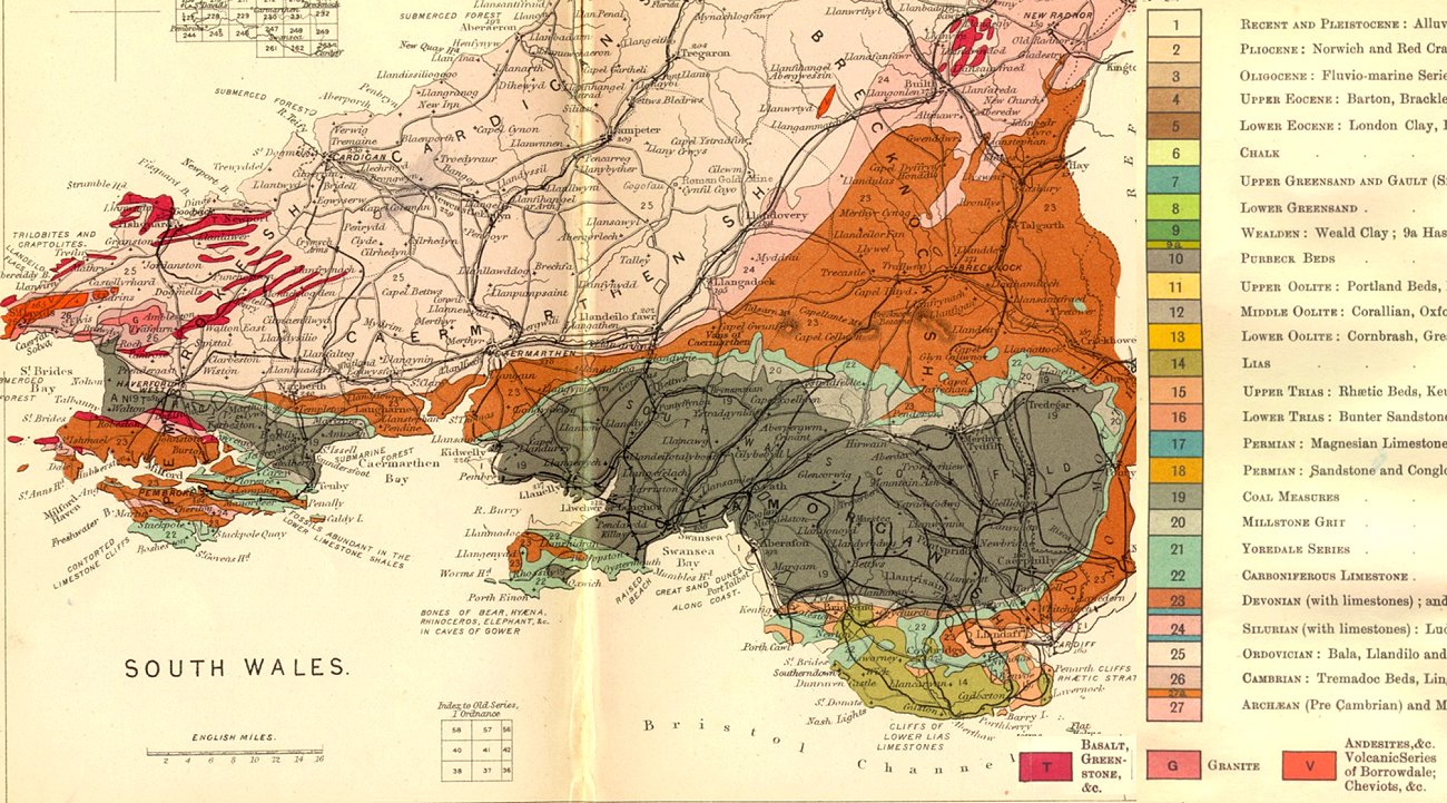 South Wales |
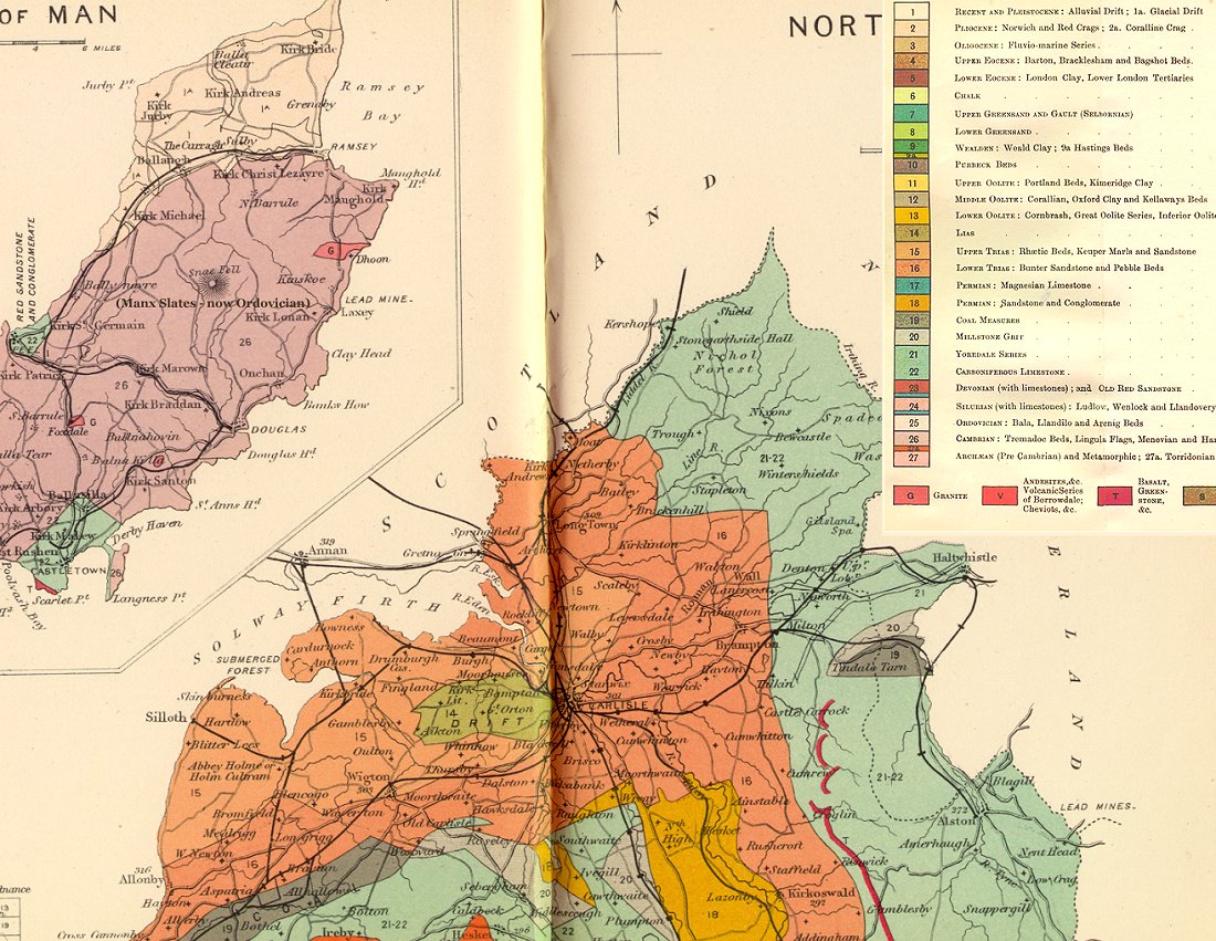 North Cumberland |
 Lake District |
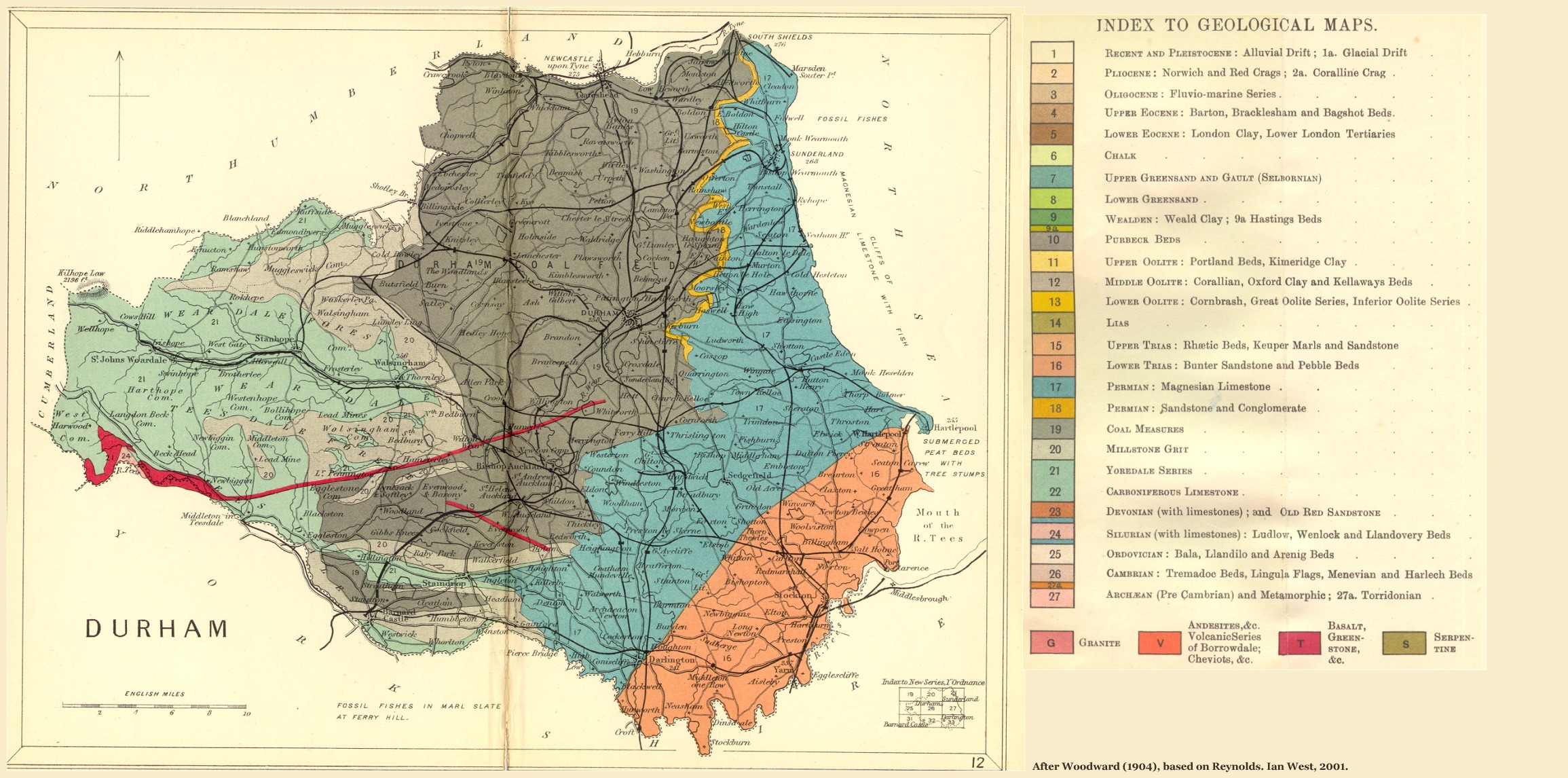 Durham |
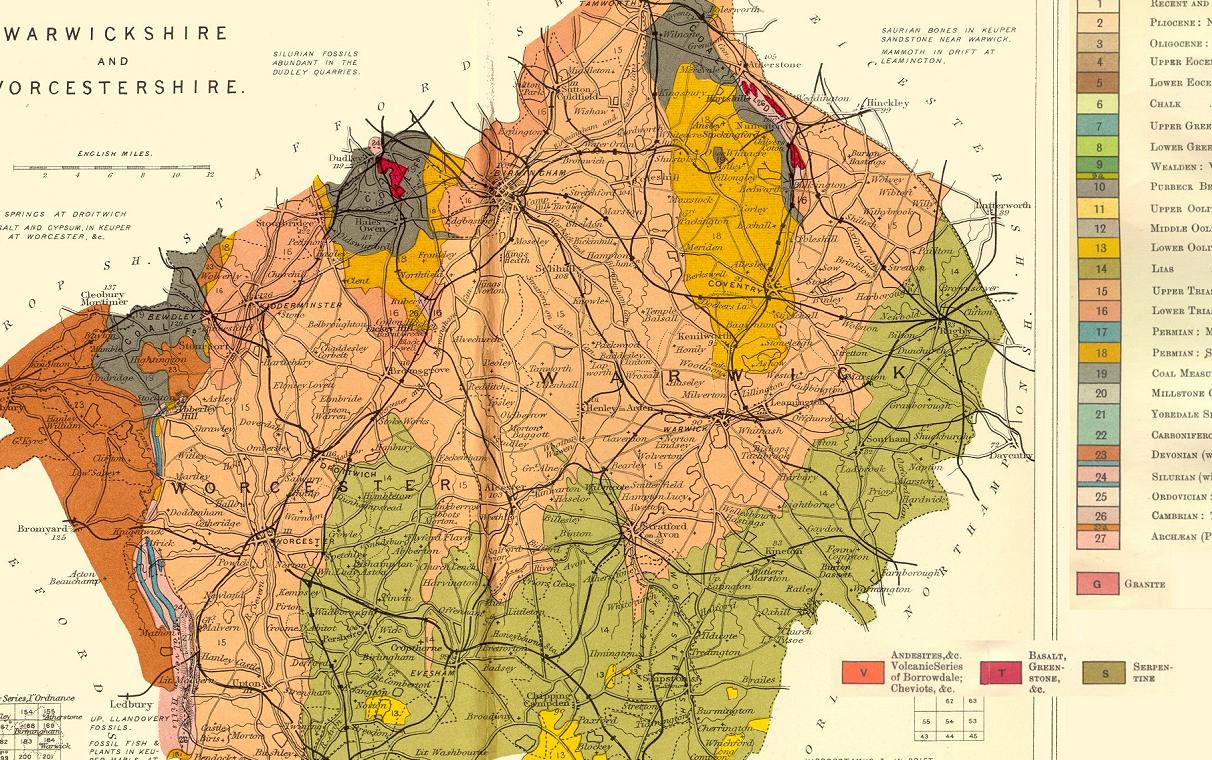 Warwickshire |
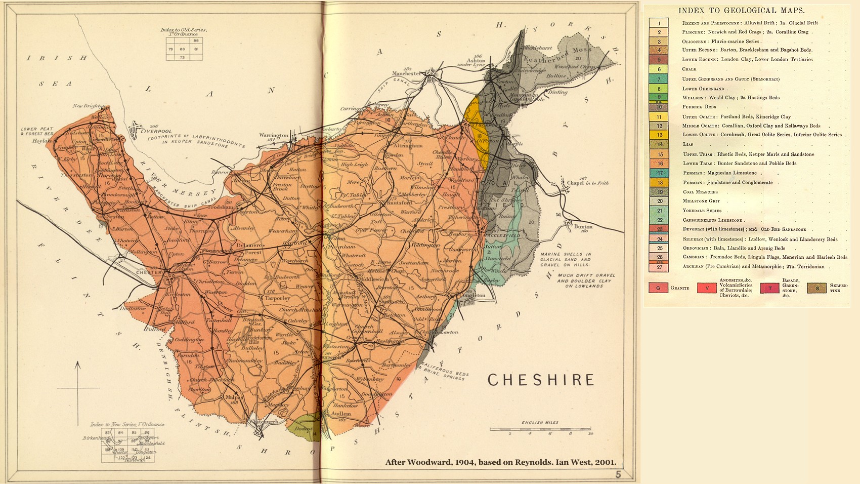 Cheshire |
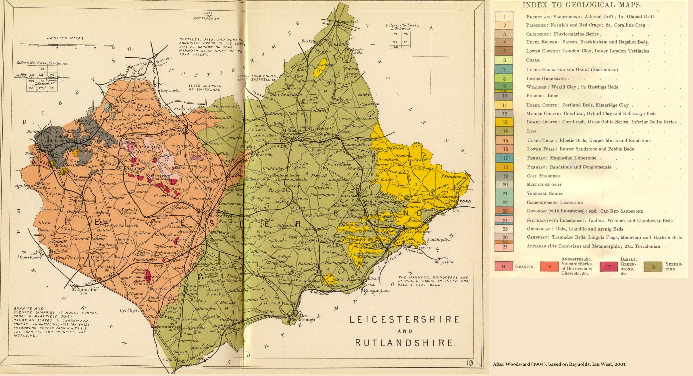 Leicestershire |
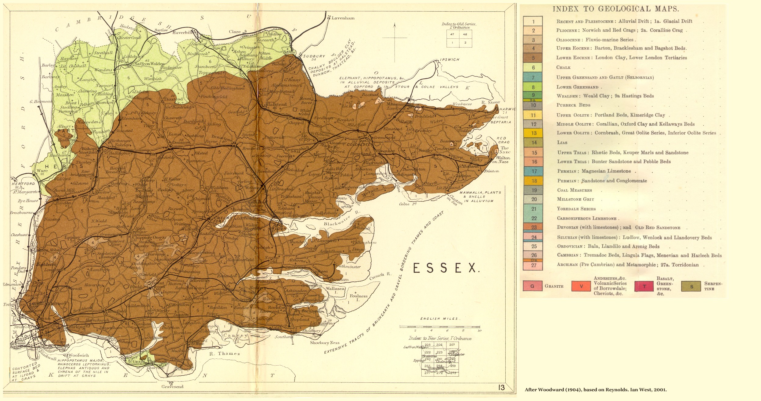 Essex |
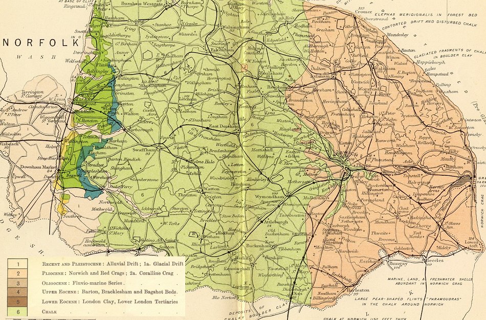 Norfolk |
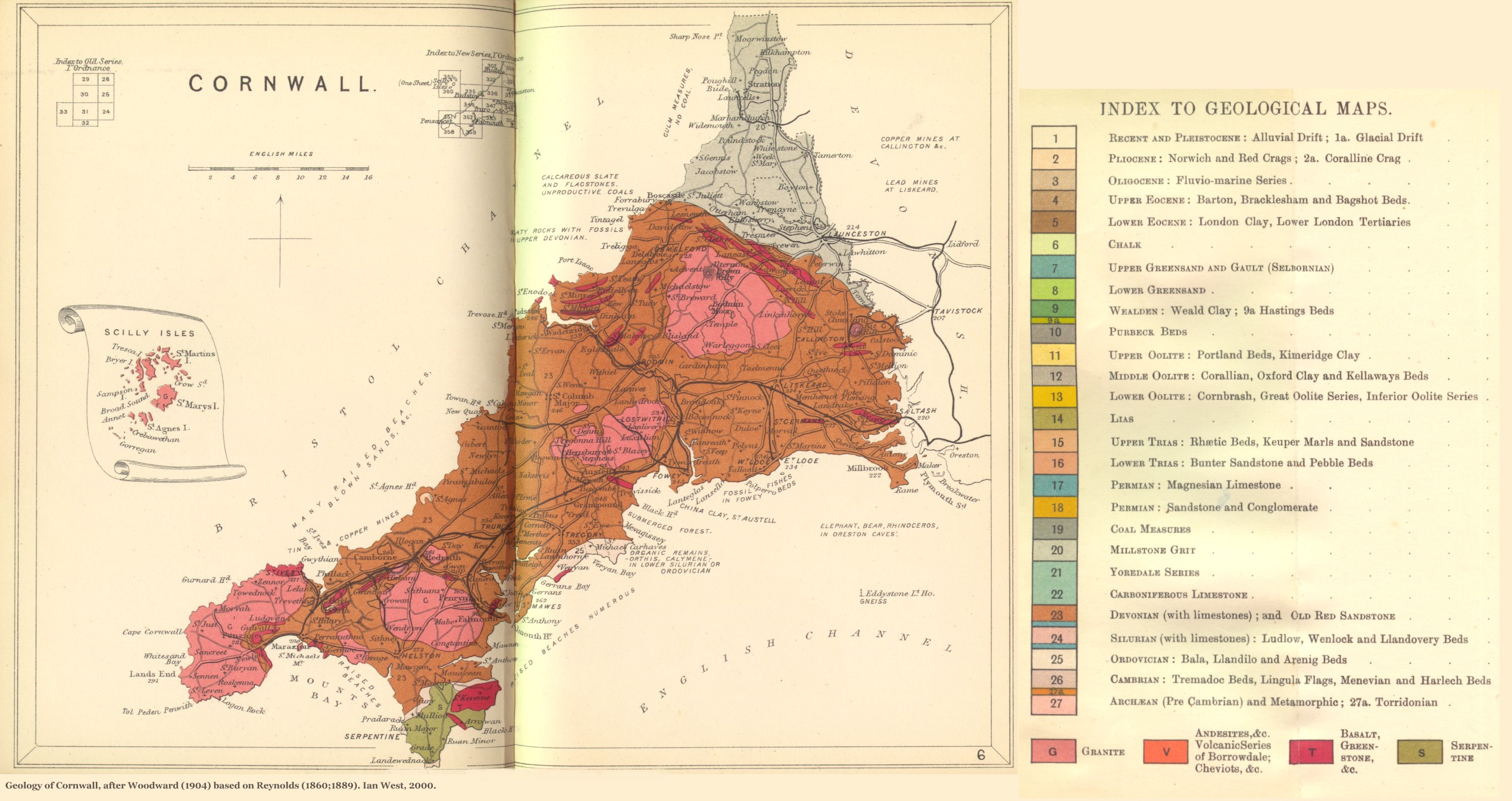 Cornwall |
 Devonshire |
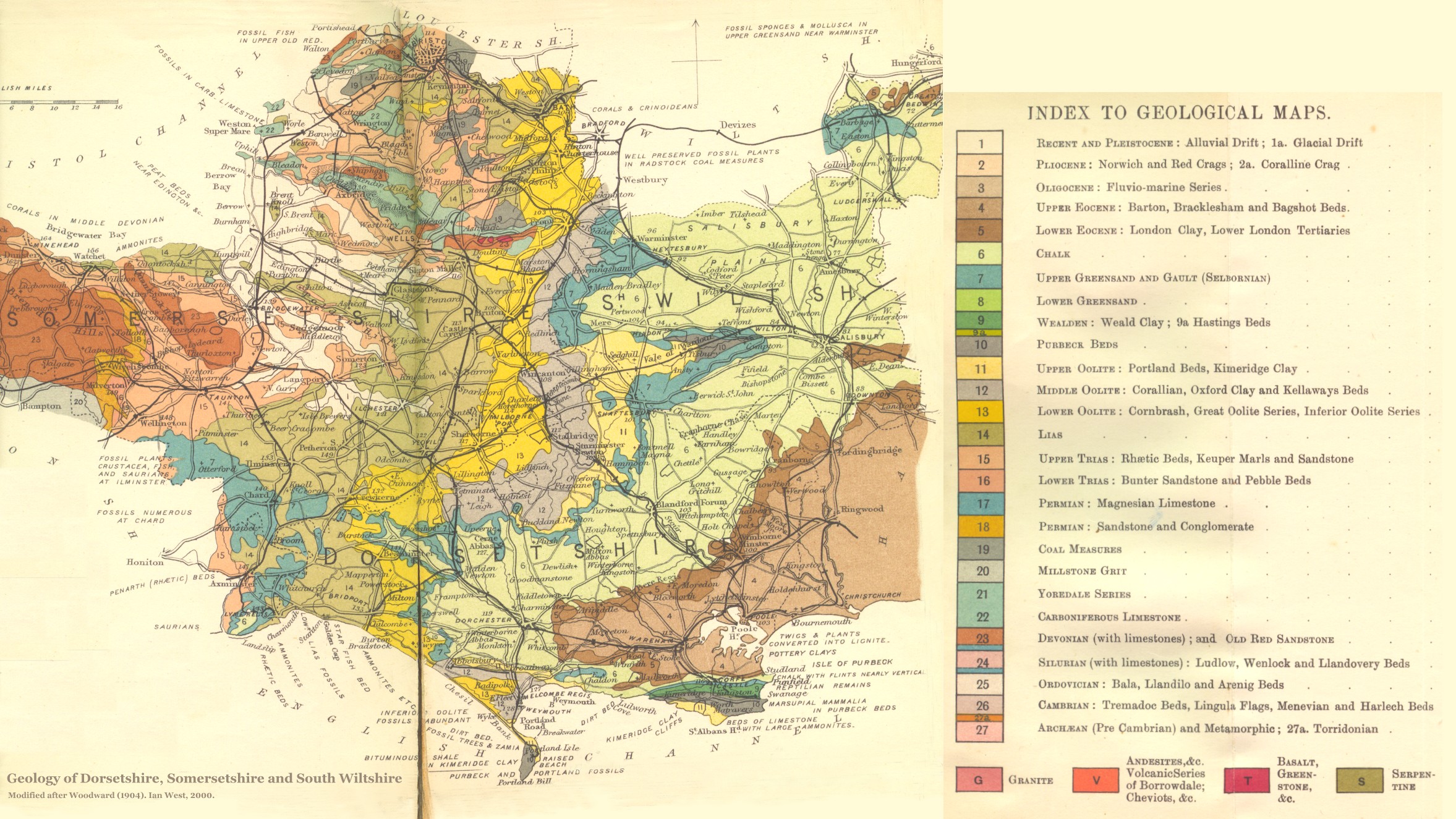 Dorsetshire |
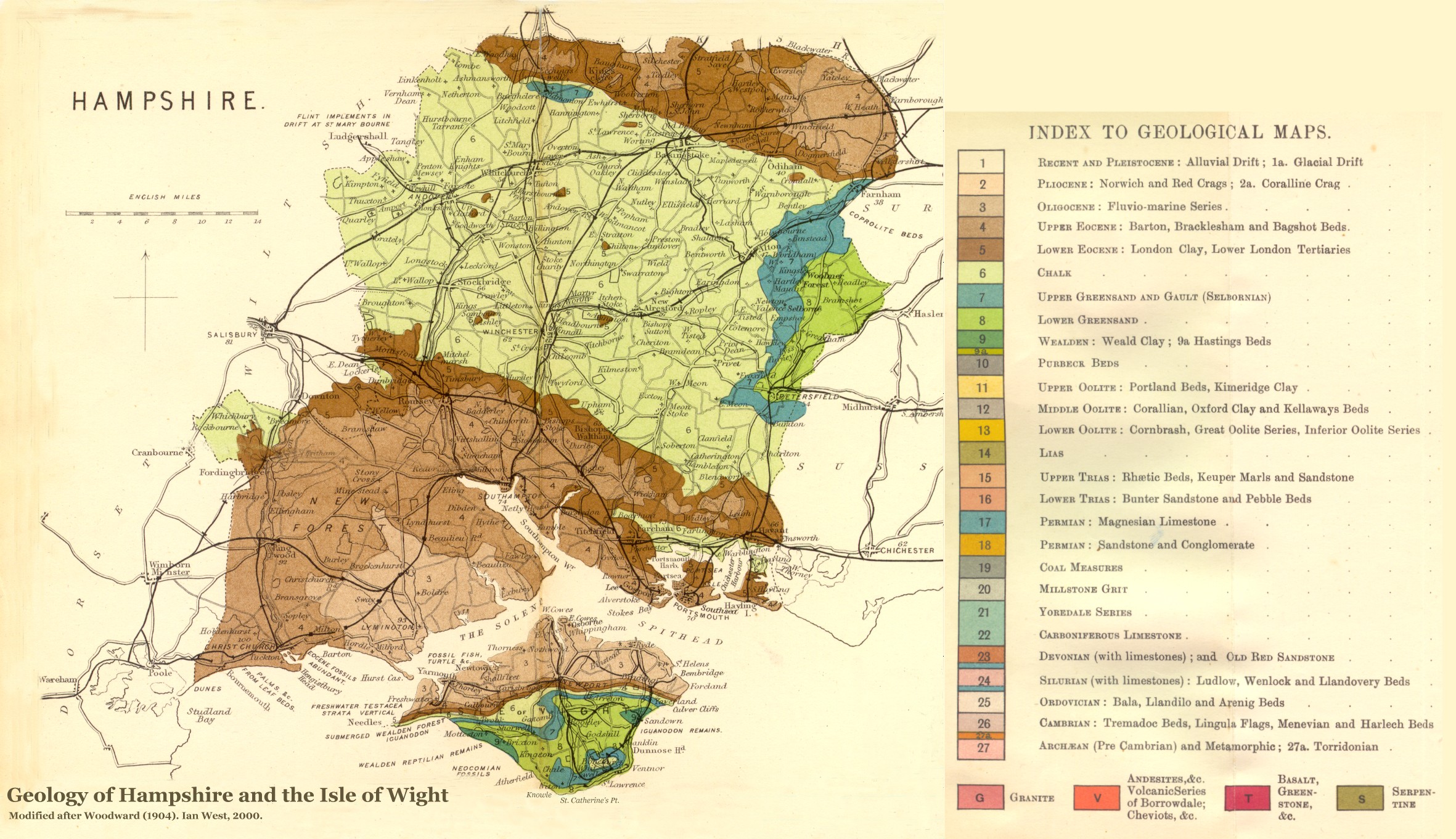 Hampshire |
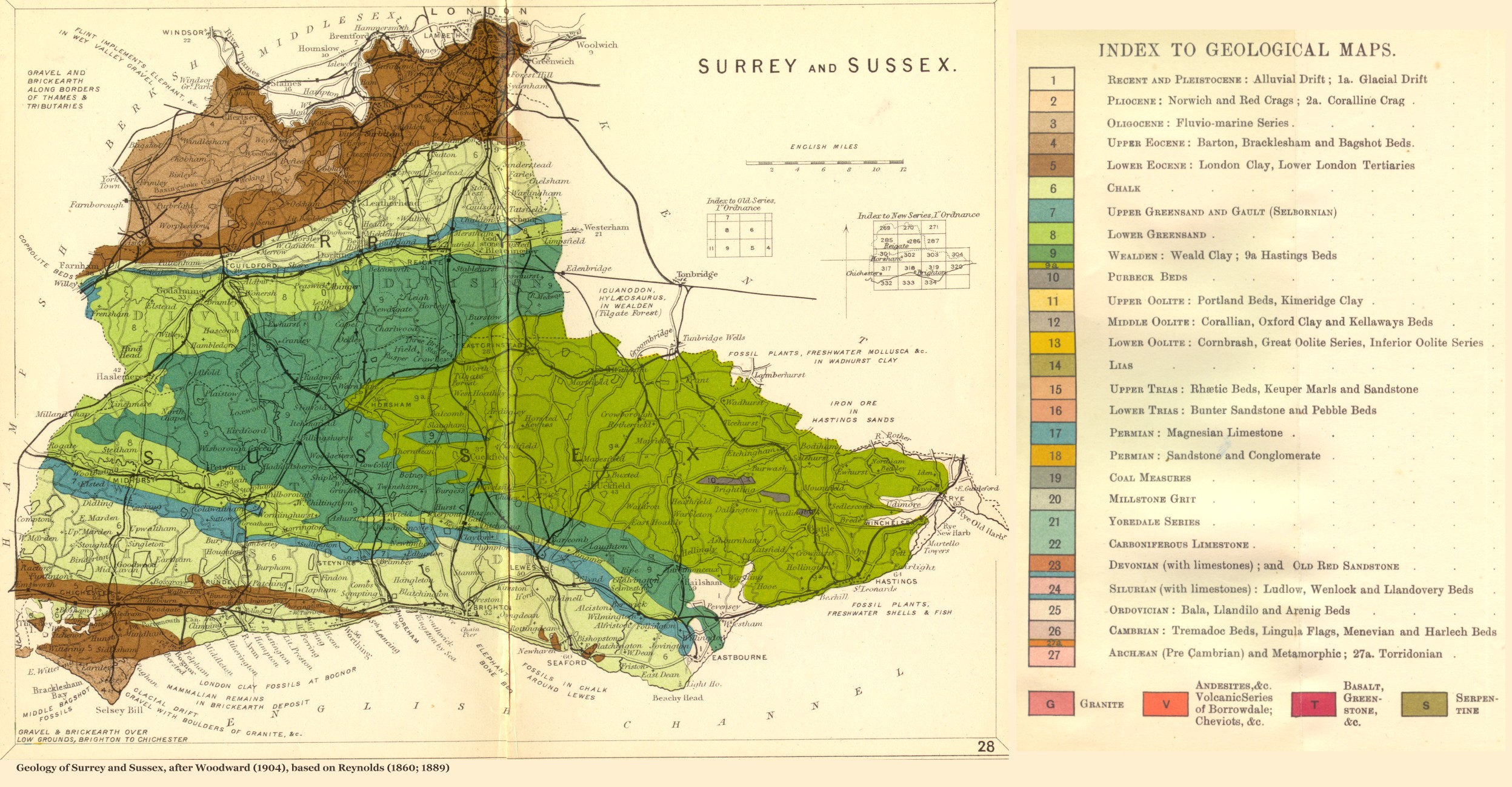 Sussex |
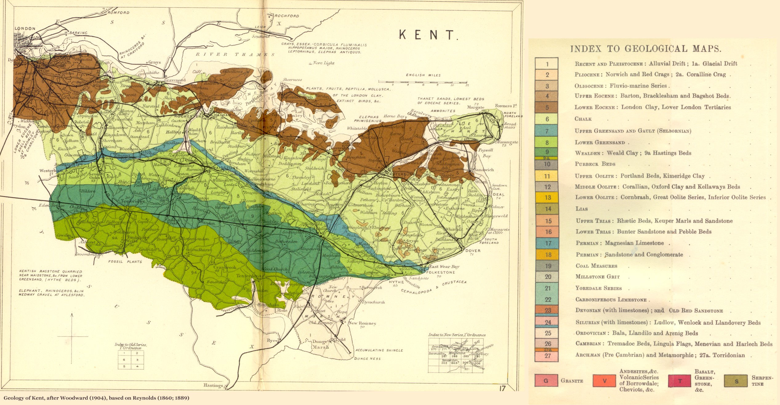 Kent |
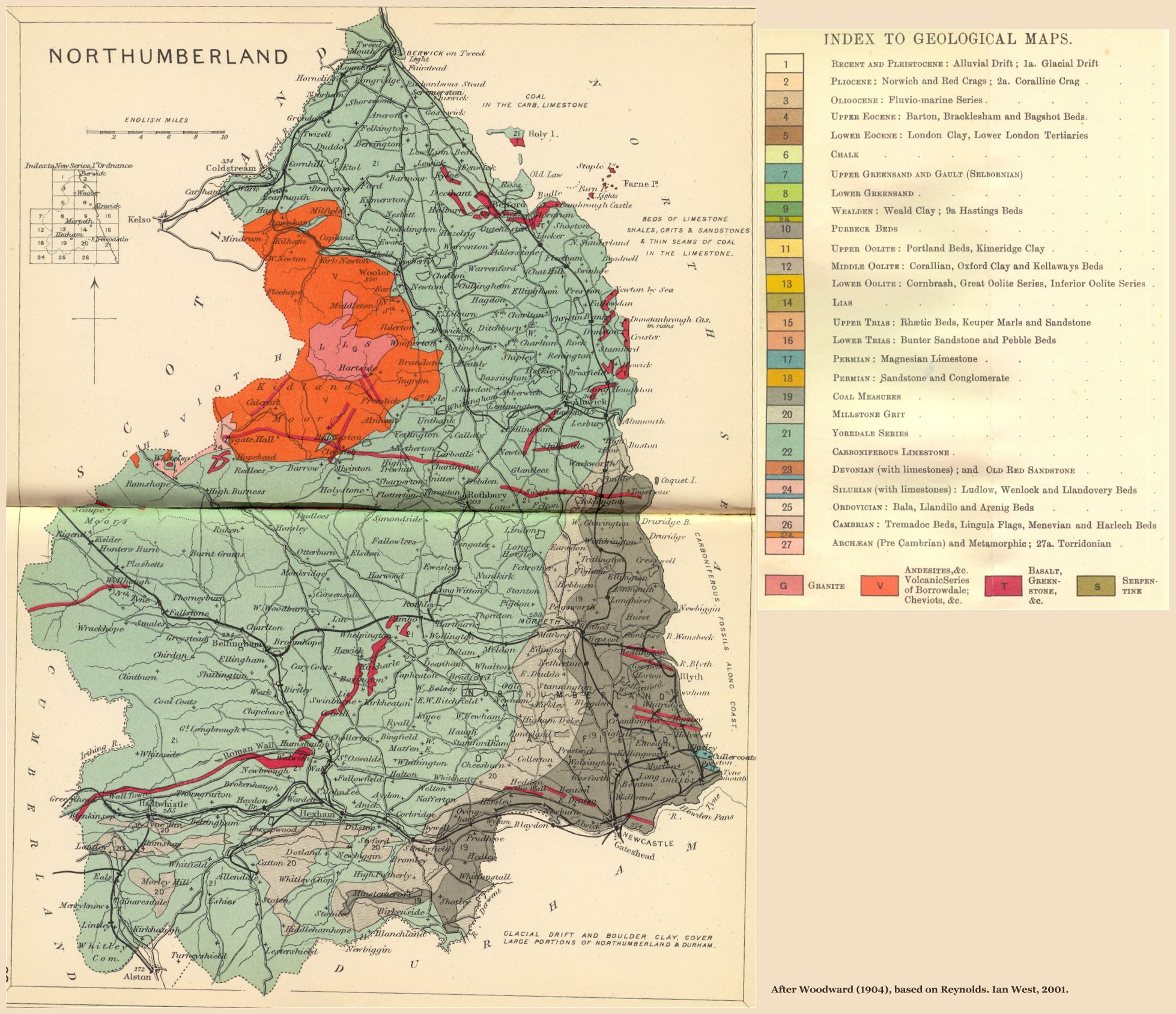 Northumberland |
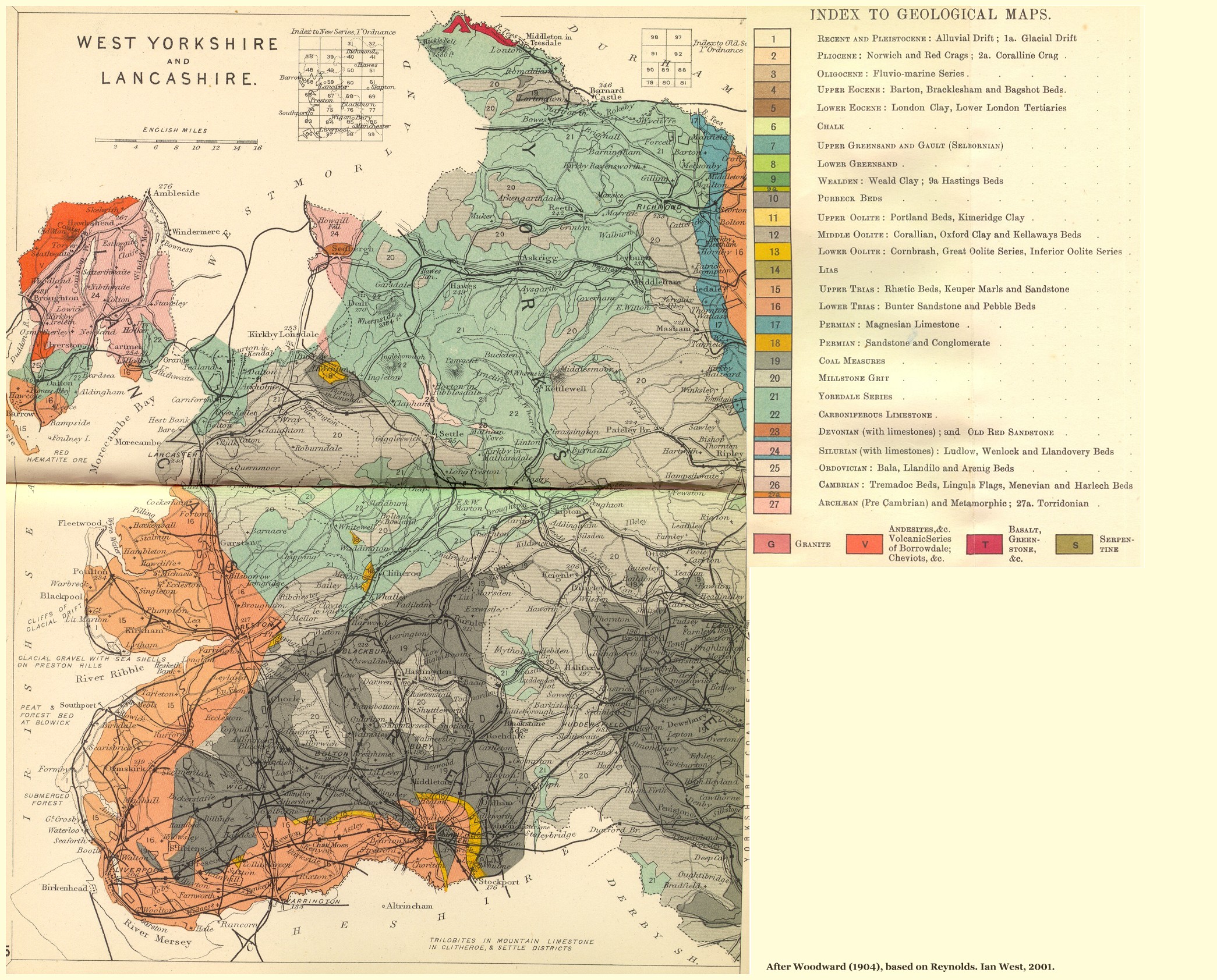 Lancashire |
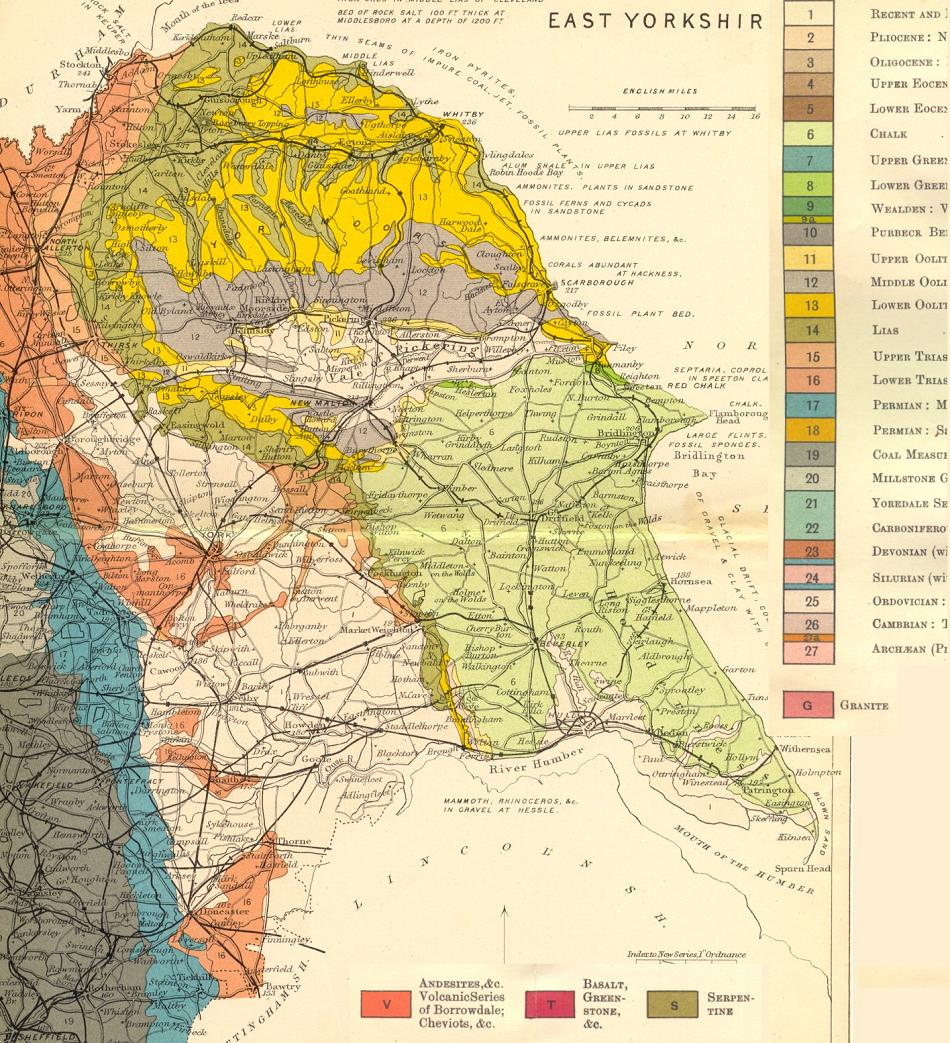 Yorkshire |
 Shropshire |
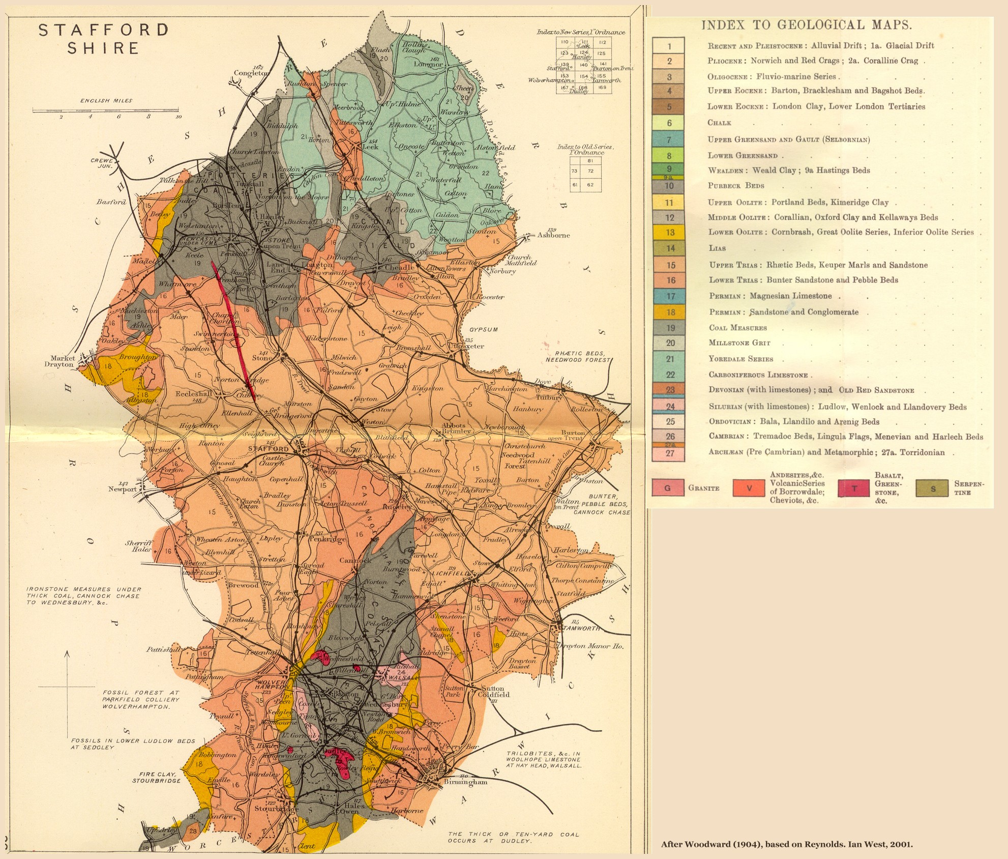 Staffordshire |
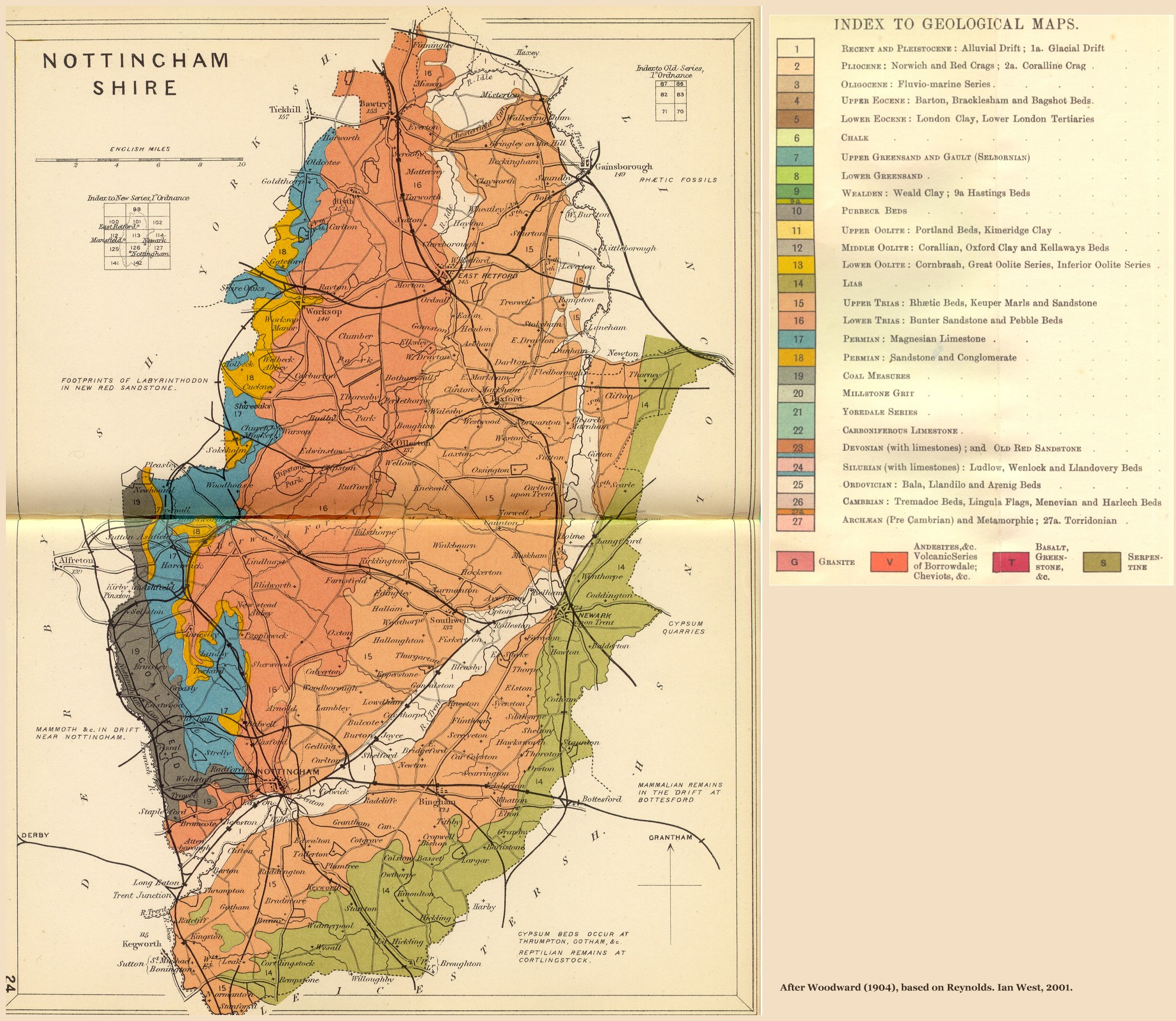 Nottinghamshire |
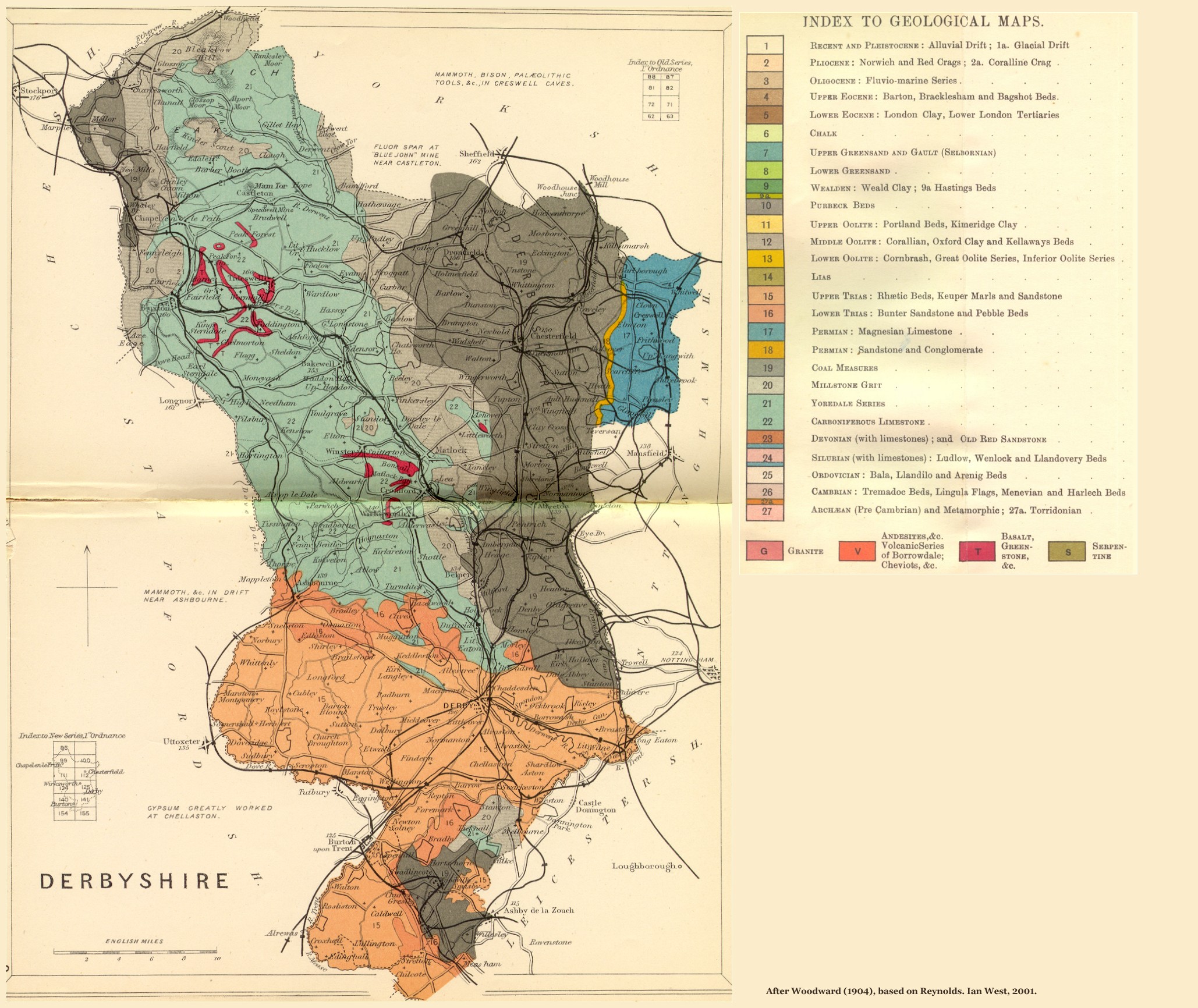 Derbyshire |
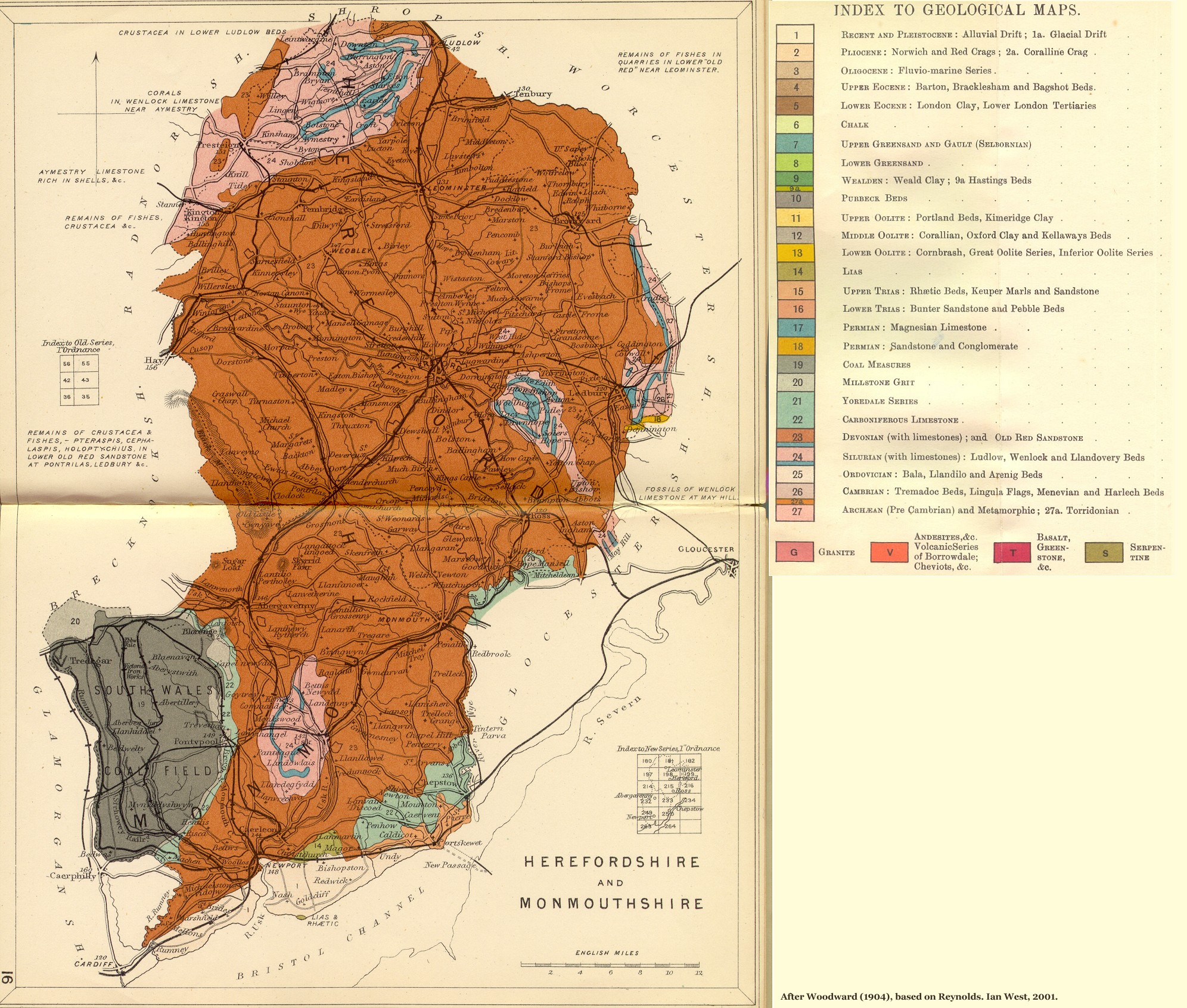 Herefordshire |
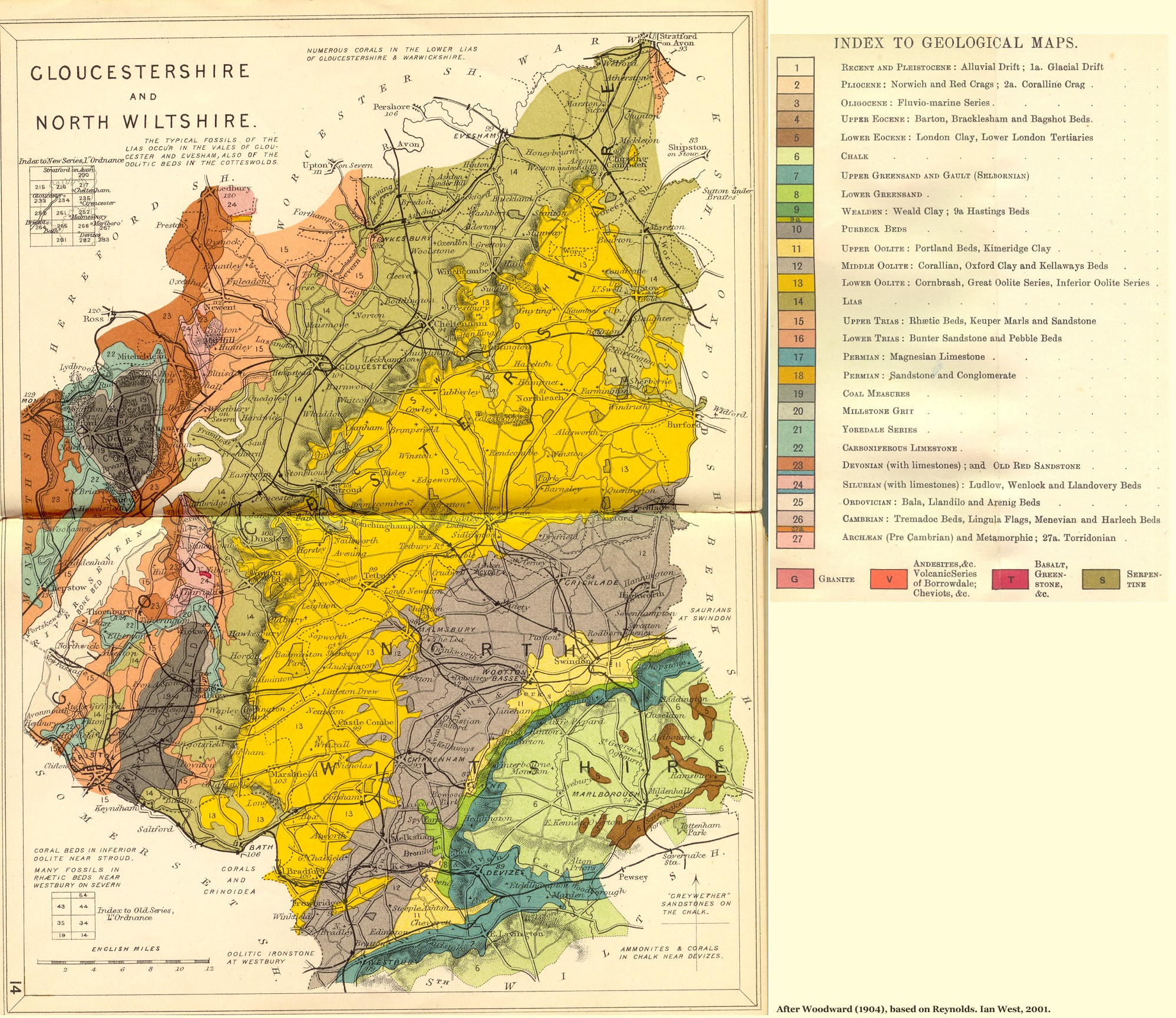 Gloucestershire |
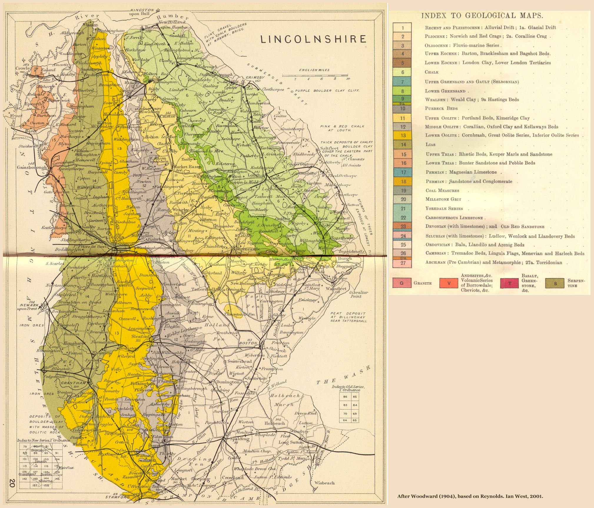 Lincolnshire |
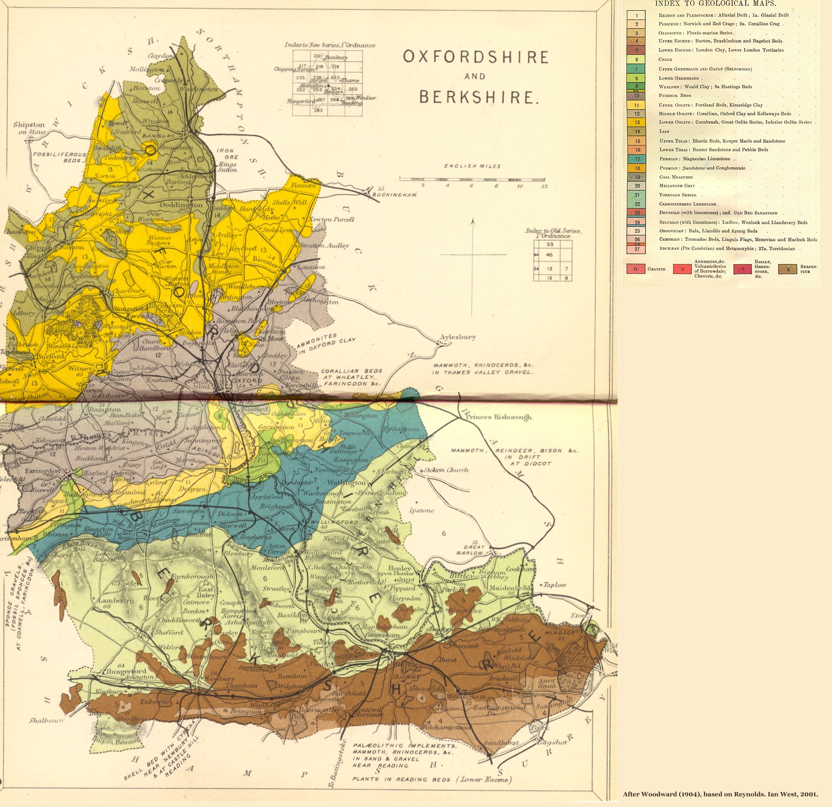 Oxfordshire |
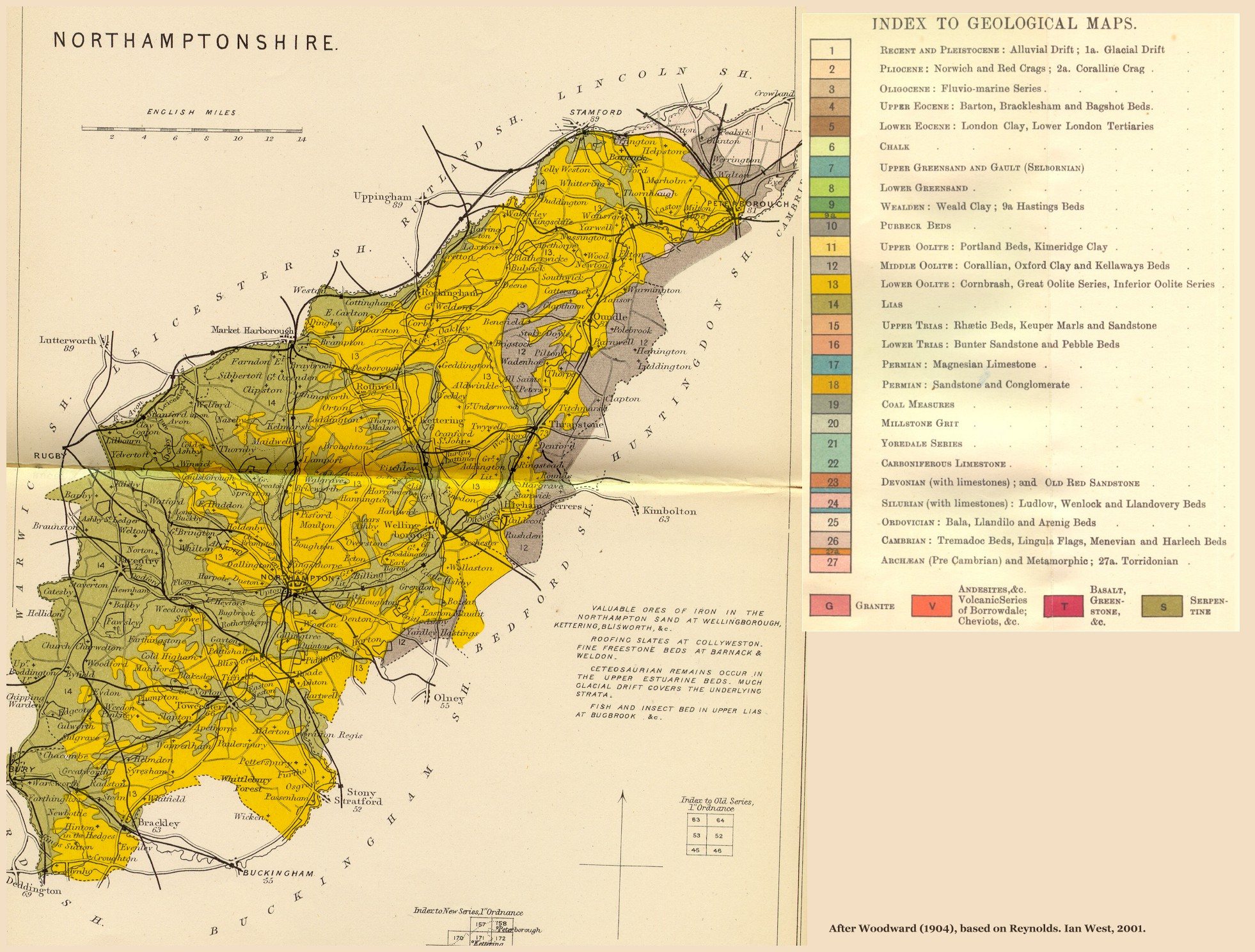 Northamptonshire |
 Cambridgeshire |
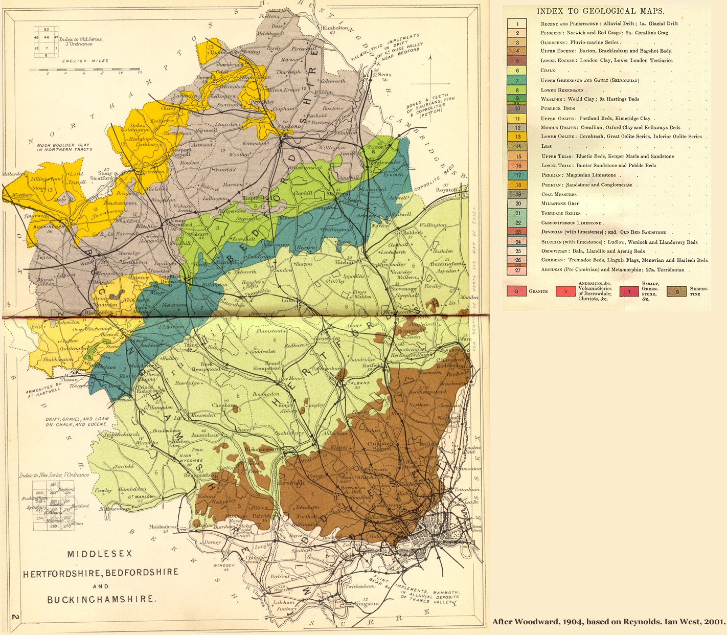 Middlesex |
||||